I am back from my hike - spirit fully recharged.

Pleased to catch up with all of you - I owe a lot of CCF responses, and will catch up as soon as I can.
Writing to give you a sense how these desert walkabouts progress.
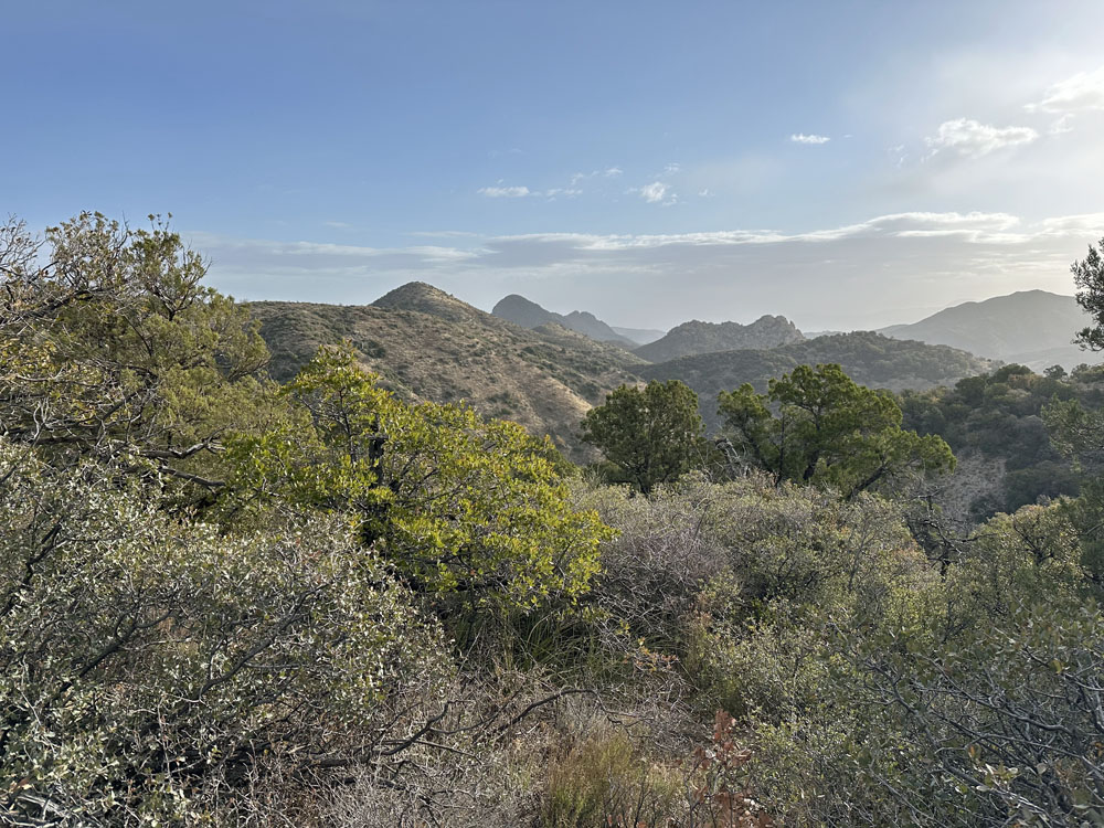
The Superstition mountain range in central AZ is a local hiking treasure. It's public land, managed by the Bureau of Land Management. Multitude of people hike this natural desert beauty.
But, if you drive to the far northern end of the Superstition range you can encounter the Federal Wilderness area. And in that area there are no other people.
This is where no motors are allowed - the most pristine and protected land we share as Americans.
We parked the Jeep at 5000' elevation and dropped off into these canyons - no trails, no paths and thankfully zero electronic access. Just brush and loose canyon rock.
It was a 600' elevation drop/slide to the local canyon bottom. Busting through brush and sliding down the canyon side on occasion.

This is our hiking 'path'. Rocks, trees and stuff to climb over.
There is thankfully zero electronic access now - we focus on one foot in front of the other as we head down canyon to find water.
We dropped into the canyon with 2 liters water each - and if we can't find water our hike is over with a grueling return.
Hiked on first day about 1.5 miles down the dry sandy, rocky canyon bottom when we thankfully found a water source at 3:30PM - just about when we had to turn around with no water.
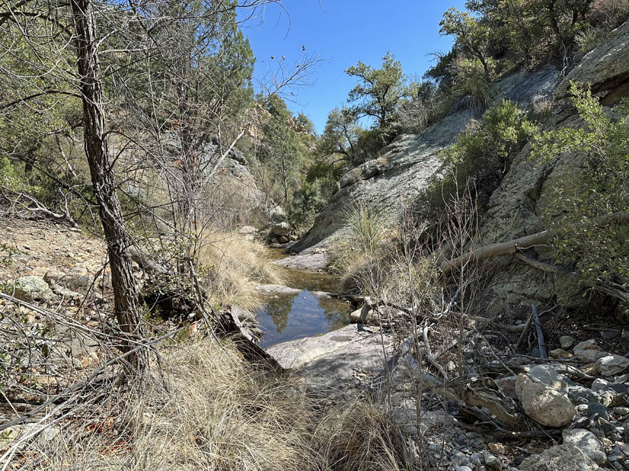
Hooray - this is a Taniah - a desert water source where the igneous geology creates a pocket for water to gather and not flow into the soil.
Our hike was saved at truly the last minute by finding this desert water source.
We rejoiced at this water source - it kept our hike alive.
Water in hand ... we make some canyon bottom lunch.
Set up a base camp about 1/4 mile up canyon from the water. Base camp was at about 3800 feet elevation - so we had a 1200 foot canyon climb to get out of there.
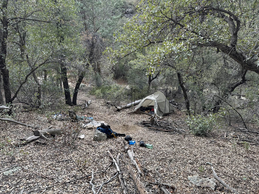
Since this was the only water source within miles, we used the base camp as our home location and made day hikes into the adjacent canyons every day.
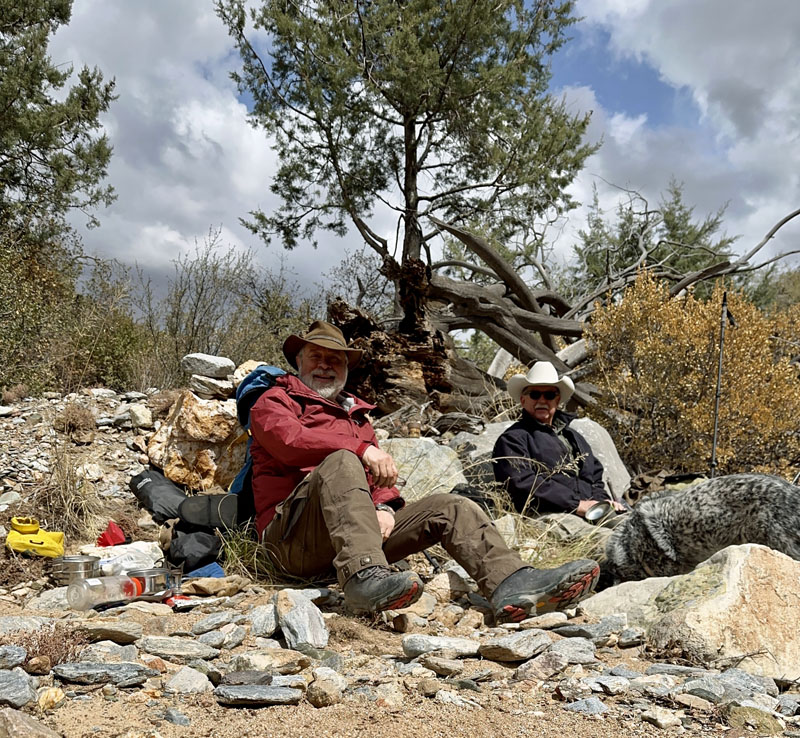
Here we are on one of those day hikes.

My hiking buddy is the former Wing Commander of the AZ Civil Air Patrol, and one of his responsibilities was AZ ground search for lost people.
We have all the tools needed to keep track of our location in the canyon bottoms. Here Rob is using his satellite connected GPS loaded with every AZ top map.

At the end of each day we relaxed at base camp with a fine oak fire, books and here I have my slippers on.


Somehow our whiskey container seems to dominate the front of that image. Did I mention that we had a bit of whiskey with us as well.

After 6 days we headed back up the canyon bottom to the point where we had to go vertical over the loose rock to climb back to the jeep.
It was a great hike. My spirit is recharged and now I'm back at work and looking forward to catching up on all the posts I missed.
Take a look at my other hobby ...
http://www.jk-dk.art